Participantes
Lisa
Steve
Filipe (port)
Martina (Ital)
Adam (dinam)
Phelipe (Czech)
Katryn (Czech)
Lucia (Slovak)
Lior
Maya (Antiq)
Maian
(Antiq)
Omri
(Antiq)
Ron
Genia
Yael
Larissa
Visitas
Yoav Avne
Naomi Porat
Gala
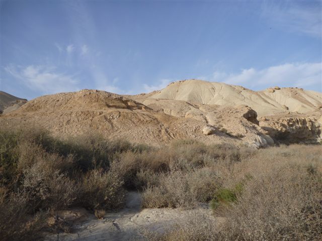
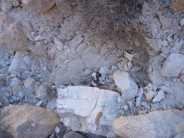
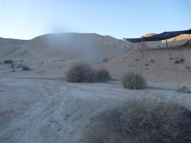
BOKER A e D
Os sites em Boker escavados nesse trabalho de campo são o Boker A (o mais a esquerda) e o Boker D.
Estao a menos de 20 m um do outro
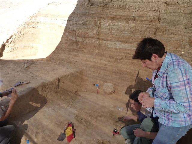
A litologia é composta de siltes com concrecoes e camadas argilosas. Há intercalados de gipso e sal, em lâminas com cristais em espiculas.
Ha estruturas de gipso (sao de gipso mesmo, comprovadas por IR) que se concentram nas camadas ricas em argila-silte, com poucos granulonos maiores.
Sugeri que essas estruturas sao semelhantes ao que se ve hoje no death valley. Naomi acha que poderiam ter sido mud cracks onde o gipso se infiltrou. O ambiente portanto seria de uma playa ou lago sem saida da agua, onde haveria a precipitacao dos evaporitos. A grande concentracao de flints nessas estruturas pode estar ligada ao trapeamento dessas ferramentas pelas estruturas evaporiticas. Esse sitio, pode ter sido por algum tempo uma especie de oasis.
Aparentemente as camadas de gipso nao sao as mesmas que a de sal. A precipitacao pode ter sido fracionada?
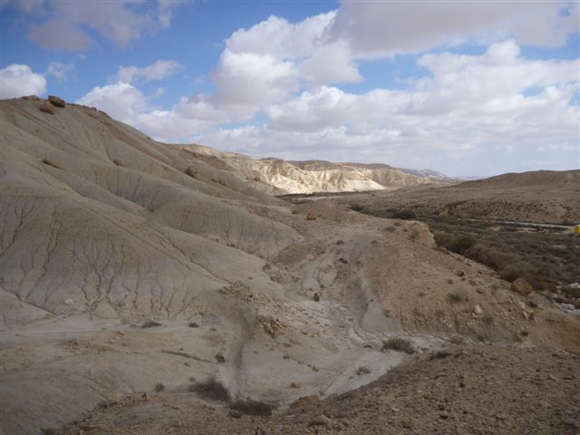
Steve: Boker A e D estao situados num remains of a Waddi terrace
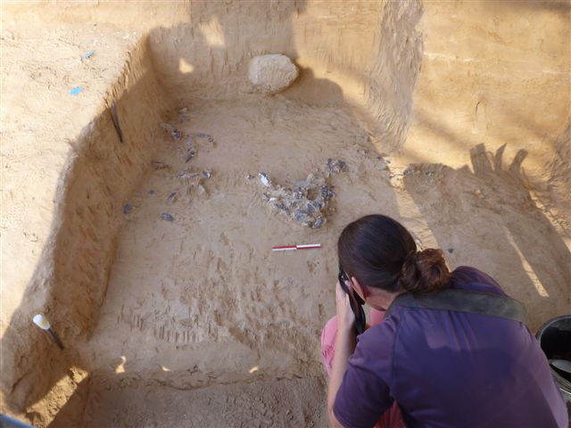
9 archeological layers
Each independent units
Approx 40 ka - Modern human migration from Africa to Asia - Datacao em Boker Tachtit, primeiro trabalho de campo na regiao feito por Tony Marks - Ele que descobriu os archeological layers em Tachtit e Boker D e A
Manot Cave - Aprox. 55 ka
Level 16. Oldest? Date?
Transition from middle to upper paleolitic
Artifacts in situ: evidence from charcoal
No bones in the outcrops
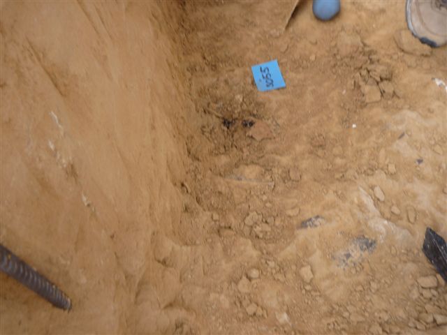
Amostras
A2 - Clump de argila de cor mais acizentada, parece que tem mais sal
A3 - Gipso?
A4 - Gipso - Comprovado por IR
A6 - Amostra parece ter HM
A7 - Oxidos e hidroxidos de Fe - Hematita comprovada por IR
A8 - Amostra de gipos com coating? - amostra coletada nos morros ao lado de Boker D
A9 - Nodulos de cobbles e fragmentos na camada abaixo da arqueologica,
A10 - Amostra retirada da pedra incrustada na parede - Mesmo material que A9?
Serao calcrete? A aluna da Naomi, Gala, achou paleosolos calcareos na regiao
Fotos:
- Foto com lente USGS - Espiculas de sal , continua a te onde o Steve trabalha
-
Visita a afloramento com Yoav Avne
Todas as formacoes sao marinhas, a qtde de sil/argila nao esta ligada a processos continentais, mas de mar profundo
Camada top - Nizana Formation- Later Eocene - Lots of chert
Abaixo - Mor Formation - Bl;ack Chert
Abaixo - Taquia Formation - Ha nodulos de minerias de sulfato. Esses poderiam ter sido os precursores da fonte de S para o gipso
No meio do Taquia - Rafia Member - E a camada branca de chalk com pouco chert- todas as outras tem bastante chert depositados aleatoriamente em lentes ou em menos intensidade em camadas irregulares. O chert desses afloramnetos e diferente do que foi knapped
O Chert visto e bastante irregular alguns pedacos chegam a 30 cm ou mais e sao bastante espessos. A maioria entretanto e pequena.
Matacao com buracos mostra a formacao de chert. As diatomaceas, radiolarias, espiculas teriam acumulado nesses buracos e com a diagenese teriam virado chert. Filipe diz que antes da diagenese ha um periodo de polimerizacao
Estudos com forminiferos na regiao permitem estimar a profundidade do mar de Thetys, que era nao tao profundo como o atual.
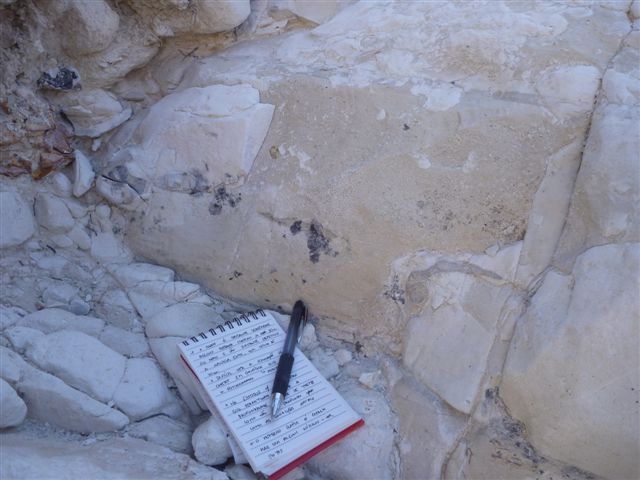
Foto com caderneta Transicao Rafia/Taquia
Percolacao de Fe e S nos cracks de chalk
Foto A - Camada + silt/arernosa com pequenos granulos, e a camada cinza clara do Boquer D, a camada + siltosa e homogenea e a marrom
Elisabetta Lecture
Dating the middle paleolitic transition
Idade C14 - Aprox 45 ka
Kebana Cave - Aprox 48 ka
Nahal Aqev - 60-50 ka ?
Boker D and A - 45-50 ka?
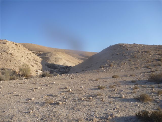
Nahal Aqev
- Naomi e Gala:
Qz e Feldspar comes with the wind - eolian
Pouco feldspato nas amostras, o maior contribuinte para o dose rate e a argila
Qtde de pesados pequena
A formacao Taquia tem muito pouco quartzo,e quando esse esta presente e eolico
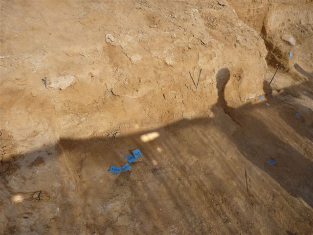
As amostras de OSL na mesma camada apresentaram dose rates diferentes e consequentemente idades. Checaram com o gamma portatil e nao houve alteracao em relacao as medidas que foram feitas no inicio do ano, exceto uma amostra na trincheira. Coletou amostras para reavaliar a taxa de dose - foi colocado um x depois do no. da amostra. Coletei as mesmas amostras e estou levando para SP. Rodei o IR delas e aparentemente sao constituidas apenas de argila, calcita e qtzo.
A amostra 5 up foi coletada num nivel provavelmente acima da amostra 5 coletada em maio. A parede original foi escavada
O clima no Negev modelado a partir de espeleotemas mostra um Quaternário tardio seco:. Gala, a aluna de pos da Naomi, me passou que durante o LGM, oclima nao deve ter sido muito diferente do atual, mas com mais frequencia de precipitacao, mas sem grandes intensidades, O vento entretanto foi mais intenso.
O inicio da erosao comecou depois do LGM
*****
Middle-Late Quaternary paleoclimate of northern margins of the Saharan-Arabian Desert: reconstruction from speleothems of Negev Desert, Israel
Anton Vaks a,b,c,*, Miryam Bar-Matthews b, Alan Matthews c, Avner Ayalon b, Amos Frumkin d
Speleothems in arid and hyper-arid areas of Negev Desert, Israel, are used in paleoclimate reconstruction of northern margins of Saharan-Arabian Desert, focused on the following objectives: 1) precise UeTh dating of the timing of speleothem growth as an indicator of periods of humid climate, i.e. positive effective precipitation; 2) the origin of rainfall using the speleothem d18O and changes in spatial pattern of speleothem deposition and speleothem thickness along a northesouth transect; 3) changes of vegetation cover based on speleothem d13C variations. During the last 350 ka major humid periods, referred to herein as Negev Humid Periods (NHP),
occurred in the central and southern Negev Desert at 350e310 ka (NHP-4), 310e290 ka (NHP-3), 220e190 ka (NHP-2), and 142e109 ka (NHP-1). NHP-4, NHP-2 and NHP-1 are interglacial events, whereas NHP-3 is associated with a glacial period. During NHP-1, 2 and 3 the thickness and volume of the speleothems decrease from the north to the south, and in the most southern part of the region only a very thin flowstone layer formed during NHP-1, with no speleothem deposition occurring during NHP2 and 3. These data imply that the Eastern Mediterranean Sea was the major source of the rainfall in northern
**********
Interglacial and glacial desert refugia and the Middle Paleolithic of the Azraq Oasis, Jordan
Carlos E. Cordova a,*, April Nowell b, Michael Bisson c, Christopher J.H. Ames c,
James Pokines d, Melanie Chang e, Maysoon al-Nahar f
A geoarchaeological study of sediments in the Azraq Oasis, in the Eastern Desert of Jordan, provides information on the fluctuations of the geomorphic and hydrologic systems in this region in relation to the local Middle Paleolithic and Upper Paleolithic occupations. The study shows that local geomorphic and hydrological environments fluctuated between marsh, lake and playa (dry lake bed with eolian activity and/or carbonate accumulation). In some instances, local wet conditions correlate with those registered in other regional paleoclimatic records, as is the case of the period comprising MIS 5a and probably early MIS 4. In other cases, however, local wet conditions represented by marsh deposits with hominin occupations are asynchronous with regional wet conditions. This suggests that the Azraq oases may have acted as desert refugia at times of regional adverse climatic conditions. The fact that Azraq represents a potential desert refugia has important consequences for understanding major issues in the Middle Paleolithic of Southwest Asia, namely (1) the arrival, survival, and extinction of populations of both Neanderthals and early modern humans. The location of Azraq at a crossroads between the Levant, the Arabian Peninsula and other regions of the Middle East, is also an important geographic aspect of desert refugia during the critical period of hominin dynamics in the Middle Paleolithic.
6. Conclusions
Wet and dry phases in regional paleoclimatic records across the
Levant and the Syro-Arabian Desert show north-to-south timing differences, marked on the one hand by the influence of Atlantice Mediterranean cyclogenesis in the north, and the summer monsoon influence in the south. These latitudinal timing differences have recently been pointed out as a catalyst for modern human migrations from Africa to the Levant and to other parts of Southwest Asia (Vaks et al., 2006, 2007, 2010; Frumkin et al., 2011). However, at the same latitude, records vary in timing, suggesting that while some regions remained dry, others stayed locally wet, hence suggesting the existence of desert refugia for hominin populations. Under wet conditions, lakes occupied the former basins, making the possibility of higher mobility and long distance migration. In this respect, the Azraq Oases seem to have played an
important role in hominin population dynamics in the northern Arabian Desert because of its location at crossroads along thoroughfares of paleolakes and springs connecting the Levant and Arabian Peninsula via the Wadi Sirhan DepressioneGreater anNafud corridor facilitating the diffusion of hominin populations and technologies. Ongoing research has provided the basis for studying the Azraq
important role in hominin population dynamics in the northern Arabian Desert because of its location at crossroads along thoroughfares of paleolakes and springs connecting the Levant and Arabian Peninsula via the Wadi Sirhan DepressioneGreater anNafud corridor facilitating the diffusion of hominin populations and technologies. Ongoing research has provided the basis for studying the Azraq
Oases as desert refugia in the Jordanian Desert. But thus far, geoarchaeological record in the Greater Azraq Oases Area shows that an important regional wet period occurred between MIS 5c to early MIS 4 attracting hominin populations making Middle Palaeolithic tools. During this time many other basins in the region contained lakes, facilitating movement of populations across the vast SyroArabian Desert. At later times, such as late MIS 4, MIS 3 and MIS 2, marshes existed in Azraq when other records show regional dry and cold conditions.
**********
Transition from arid to hyper-arid environment in the southern Levant deserts as recorded by early Pleistocene cummulic Aridisol
2011
Rivka Amit a,*, Ori Simhai a,b, Avner Ayalon a, Yehouda Enzel b, Ari Matmon b, Onn Crouvi a,b, Naomi Porat a, Eric McDonald c
The time at which deserts established their current arid or hyper-arid conditions remains a fundamental question regarding the history of Earth. Cosmogenic isotope exposure ages of desert pavement and welded, calcicegypsicesalic Reg soils that developed on relatively flat alluvial surfaces ∼2 Ma ago in the Negev Desert indicate long geomorphic stability under extremely dry conditions. Over a short interval during their initial stage of development between 1e2 Ma, these cumulative soils are characterized by calcic soils reaching maximum stage III of carbonate morphology. This interval is the only period when calcic soil horizons formed on stable abandoned alluvial surfaces in the southern Negev Desert. Since ∼1 Ma pedogenesis changed toward more arid soil environment and the formation of gypsicesalic soil horizons that were later followed by dust accumulation. The dichotomy of only moderately-developed calcic soil (stages IIeIII) during a relatively long time interval (105e106 years) indicates an arid environment that does not support continuous development but only occasional calcic soil formation. The very low d18O and relatively high d13C values of these early pedogenic carbonates support soil formation under arid climatic conditions. Such an environment was probably characterized by rare and relatively longer duration rainstorms which occasionally allowed deeper infiltration of rainwater and longer retention of soil moisture. This, in turn enabled the growth of sparse vegetation that enhanced deposition of pedogenic carbonate. At ∼1 Ma these rare events of slightly wetter conditions ceased and less atmospheric moisture reached the southern Negev Desert leading to deposition of soluble salts and dust deposited in the soils. The combination of long-term hyperaridity, scarcity of vegetation and lack of bioturbation, salts cementation, dust accumulation and tight desert pavement cover, has protected the surfaces from erosion forming one of the most remarkably stable landscapes on Earth, a landscape that essentially has not eroded, but accumulated salt and dust for more than 106 yr.
3. Methods
The methods used in this study are aimed at characterizing the
soil properties resolving the cycles of soil formation in the cumulative-welded soil profile which are exposed for long time. We characterized the soil by its geochemical profile and particle size distribution (PSD).
*******
Abandonment ages of alluvial landforms in the hyperarid Negev determined by luminescence dating
N. Porat a,*, R. Amit a, Y. Enzel b,c, E. Zilberman a,Y.Avni a, H. Ginat d, D. Gluck a,b
In hyperarid regions, pedoturbation is minimal and the silt and
clay dust particles that are deposited on top of the surfaces do not infiltrate below the gypsic horizon (0.3–0.7 m). For luminescence dating, these particles can be avoided by sampling immediately below that horizon and by using only sand-size particles in analyses (Porat et al., 1996; 1997). Past moisture contents in these regions is well constrained; the presence of salt and gypsum horizons in the reg soils indicates that moisture was always very limited (Amit et al., 2006; Enzel et al., 2008), probably similar to present day measured values of 1–3%. U-series disequilibrium is not significant under such dry conditions.
Although the sediments are mainly gravels, there was always
sufficient sand-size quartz or alkali feldspar (KF) present in lenses or beds. The quartz in the N. Shehoret alluvial fans derives from recently eroded Precambrian granites and Paleozoic sandstones occurring nearby. As a consequence, the quartz has a weak OSL signal and low sensitivity (Pietsch et al., 2008), resulting in a large scatter of the equivalent dose (De) measurements. In contrast, the quartz in the N. Zin and N. Ze’elim terraces is mostly aeolian dust, brought by dust storms fromNorth Africa, deposited on slopes and then washed into the fluvial system (Haliva-Cohen, 2004). Its OSL signal is strong and is highly suitable for dating. Thus, the choice between measuring quartz and KF depended on their luminescence properties, abundance and level of signal saturation, and in general KF was measured in N. Shehoret and quartz in N. Zin and N. Ze’elim
*******
GIPSUM
Gypsum is a common mineral, with thick and extensive evaporite beds in association with sedimentary rocks. Deposits are known to occur in strata from as far back as the Archaean eon.[9] Gypsum is deposited from lake and sea water, as well as in hot springs, from volcanic vapors, and sulfate solutions in veins. Hydrothermal anhydrite in veins is commonly hydrated to gypsum by groundwater in near-surface exposures. It is often associated with the minerals halite and sulfur. Gypsum is the commonest sulfate mineral.[10] Pure gypsum is white, but other substances found as impurities may give a wide range of colors to local deposits.
Because gypsum dissolves over time in water, gypsum is rarely found in the form of sand. However, the unique conditions of the White Sands National Monument in the US state of New Mexico have created a 710 km2 (270 sq mi) expanse of white gypsum sand, enough to supply the construction industry with drywall for 1,000 years.[11] Commercial exploitation of the area, strongly opposed by area residents, was permanently prevented in 1933 when president Herbert Hoover declared the gypsum dunes a protected national monument.
†*********†*****
9-nov-2016
Visita de Naomi Nahal Aqev
Problemas com idades de amostras coletadas na mesma camada, com doses praticamente iguais mas com taxas de dose muito diferentes. Idades ficam então muito diferentes.
Levou o medidor de gamma portátil e nos pontos de coleta nos perfis de cima, 1x,2x,3x,4x, 5 up e 16, os valores foram iguais. Mesmo perfurando mais os buracos e tirando amostras mais do fundo. Ela levou de cada ponto um pouco de sedimento para fazer novas análises químicas. Eu tbm coletei de casa ponto uma considerável quantidade de sedimentos para fazer granulometria e susceptibilidade magnética.


Nenhum comentário:
Postar um comentário